
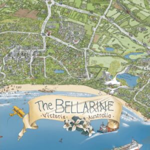

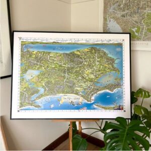
Bellarine Map Posters

Price range: $35.00 through $120.00
Stunning hand illustrated map of the Bellarine Peninsula VIC – our home.
- Description
- Additional information
- SPECIFICATIONS
- SHIPPING & RETURNS
Description
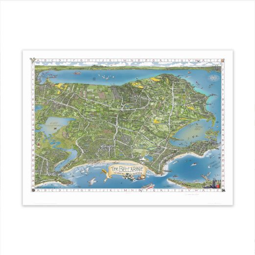
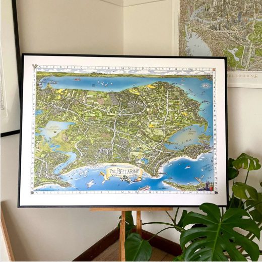
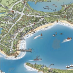
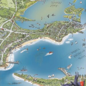
THE BELLARINE MAP – available in four sizes (unframed)
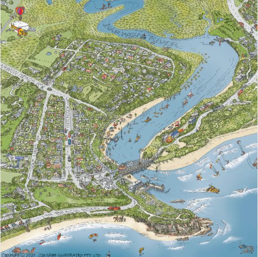
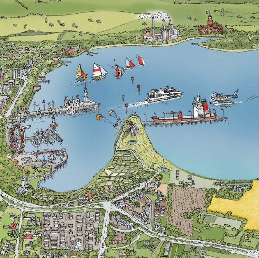
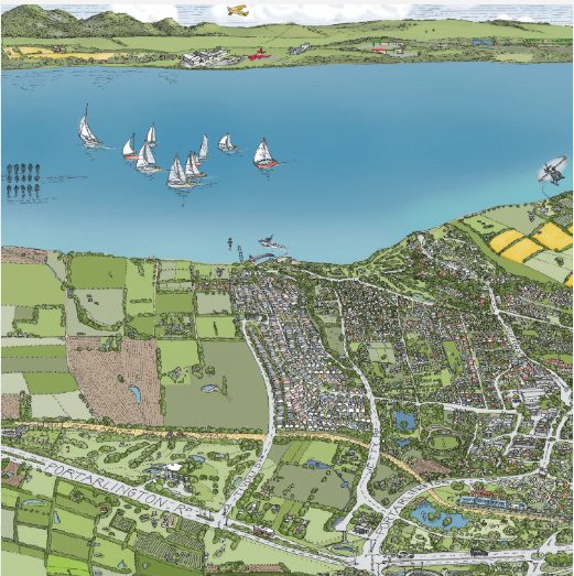
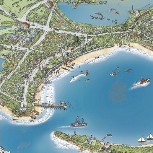
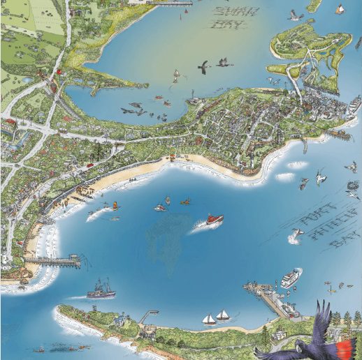
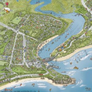
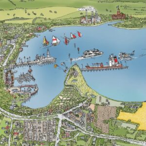
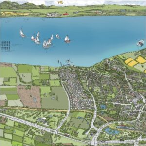
This joyful hand-drawn map of The Bellarine has it all – documenting the beautiful coastal vistas and everything in-between. Locals and visitors will cherish the capture of their favourite wineries, golf clubs, attractions, cafes, beaches, bike tracks, railways, ships, sailboats and ferries, water activities, wildlife, landscape and more.
Produced, hand-drawn, coloured and printed locally!
Areas covered include Queenscliff, Point Lonsdale, Ocean Grove, Barwon Heads, Marcus Hill, Wallington, Swan Bay, Mannerim, St. Leonards, Indented Head, Portarlington, Drysdale, Clifton Springs, Curlewis, Leopold, Moolap, a touch of Geelong, past the You Yangs and up to Melbourne – oh and a sneak peek of Sorrento and that other peninsula!
The Bellarine Peninsula is on Wadawurrung Country.
Each print comes with a Grid Reference & “Can You Find?” list.
Additional information
| Weight | 1 kg |
|---|---|
| Dimensions | 63 × 6 × 6 cm |
| Print size | A4, A3, A2, A1 |
The Bellarine Map OPEN EDITION is available in four sizes (unframed)
A1 – 841mm x 594mm
A2 – 594mm x 420mm
A3 – 297mm x 420 mm
A4 – 210mm x 297 mm
Each print comes with a Grid Reference & “Can You Find?” list.
Framing service recommendations:
Artisan Framing & Canvases at Shed 1/4 Rajah Ct, Portarlington VIC 3223
Frames Now at multiple locations across Melbourne
Shipping is calculated at checkout.
Due to the nature of this product it cannot be returned or exchanged unless faulty.